
Fortæl dine venner om denne vare:
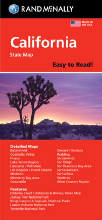
Rand McNally Easy to Read State Map California
Rand McNally
Bestilles fra fjernlager

Rand McNally Easy to Read State Map California
Rand McNally
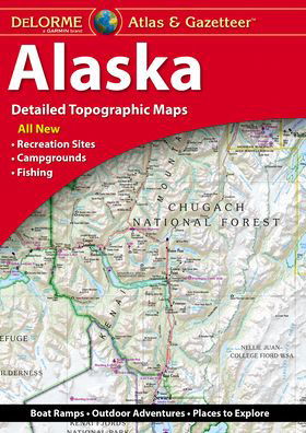
Rand McNally's Easy To Read State Folded Map is a must-have for anyone traveling in and around California, offering unbeatable accuracy and reliability at a great price. Our trusted cartography shows all Interstate, U. S., state, and county highways, along with clearly indicated parks, points of interest, airports, county boundaries, and streets. The easy-to-use legend and detailed index make for quick and easy location of destinations. You'll see why Rand McNally folded maps have been the trusted standard for years. - Regularly updated, full-color maps. - 40% larger map with a bigger type size than the Rand McNally Folded Map. - Clearly labeled Interstate, U. S., state, and county highways. - Indications of parks, points of interest, airports, county boundaries, and more. - Mileage and driving times map. - Detailed index. - Convenient folded size. Coverage Area Detailed maps of: Bakersfield, Fresno, Joshua Tree National Park, Kings Canyon Natl Park & Sequoia Natl Park, Lake Tahoe Region, Lancaster/Palmdale, Los Angeles, Modesto, Monterey/Salinas, Oceanside, Oxnard/Ventura, Palm Springs, Sacramento, San Diego.
| Medie | Bøger Hæftet bog (Bog med blødt omslag og hæftet ryg i høj kvalitet) |
| Udgivet | 7. april 2023 |
| ISBN13 | 9780528027314 |
| Forlag | Rand McNally |
| Genre | Maps & Guides |
| Mål | 90 g |
| Sprog | Engelsk |
Mere med Rand McNally


Andre har også købt
![Cover for Preben Hansen · Turen Går Til: Turen går til Californien & Vestlige USA (Hæftet bog) [5. udgave] (2021)](https://imusic.b-cdn.net/images/item/original/578/9788740063578.jpg?preben-hansen-2021-turen-gaar-til-turen-gaar-til-californien-vestlige-usa-haeftet-bog&class=scaled&v=1623395637)
![Cover for Knud Romer · Den som blinker er bange for døden (Hæftet bog) [5. udgave] (2016)](https://imusic.b-cdn.net/images/item/original/573/9788711569573.jpg?knud-romer-2016-den-som-blinker-er-bange-for-doeden-haeftet-bog&class=scaled&v=1480182943)
![Cover for Kerstin Ekman · Ulvespring (Indbundet Bog) [1. udgave] (2022)](https://imusic.b-cdn.net/images/item/original/272/9788702347272.jpg?kerstin-ekman-2022-ulvespring-indbundet-bog&class=scaled&v=1661970721)
![Cover for Jens Andersen · Kongeord (Indbundet Bog) [1. udgave] (2024)](https://imusic.b-cdn.net/images/item/original/776/9788740092776.jpg?jens-andersen-2024-kongeord-indbundet-bog&class=scaled&v=1706260512)


Se alt med Rand McNally ( f.eks. Paperback Bog , Kort , Hardcover bog , Bog og Spiralbog )